Featured Hikes: Ontario
The Trans Canada Trail in Ontario links together the fascinating history, incredible geography and thriving urban centres of Canada’s second-largest province. Whether you’re a solo adventurer or a family of outdoor enthusiasts, the Trail in Ontario has something for you to discover!
Capital Pathway
One of the largest pathway networks in North America, the Capital Pathway links parks, gardens, museums and other attractions via multi-use paths. A popular commuting option, these paths are ideal for biking, walking or running.
Head out and explore the national capital’s natural beauty, then stop at one of the region’s exceptional museums or for a snack and drink at one of Ottawa’s many delectable spots. Stroll alongside the Ottawa River to downtown Ottawa, passing by the Canadian War Museum, beautiful historic buildings, the Parliament Buildings and the northern entrance to the Rideau Canal.
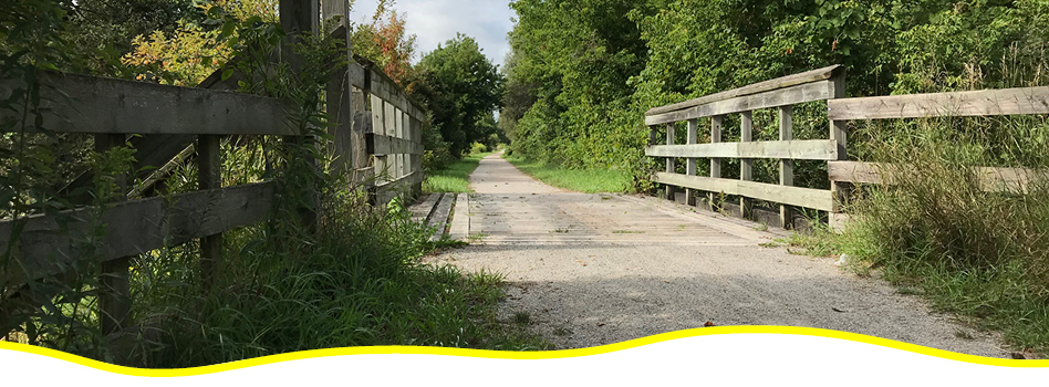
Cataraqui Trail
Built on a former CN line, the Cataraqui Trail is flat and accessible with no grades of over 5%. Perfect for hybrid or mountain bikes, this trail is popular with hikers, cyclists, cross-country skiers and snowshoers.
Running from Harrowsmith to Smiths Falls, this trail passes through several communities and is known for its beauty and historical charm. Highlights include forested areas, unique geological formations, and Chaffeys Lock on the Rideau Canal. Keep an eye out for herons, ospreys and turkeys, and stop for a bite in one of the charming towns adjacent to the trail.
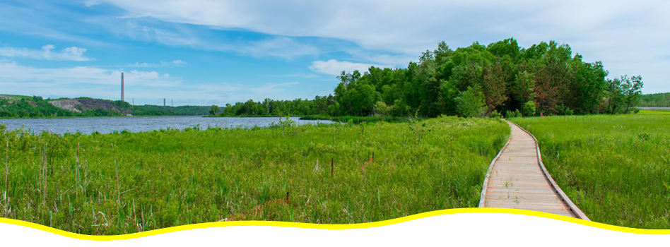
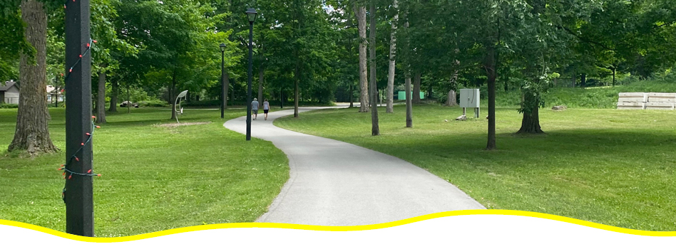
City of Greater Sudbury – Bell Park Walkway
Located south of downtown Sudbury, the City of Greater Sudbury Bell Park Walkway is an accessible and barrier-free trail running around Ramsey Lake to Science North. This popular trail includes paved and boardwalk sections and provides access to several beaches.
Hike or walk along the open path, enjoying scenic lake views and people-watching along the way. Stop at the National Mining Monument in the park and pay homage to the region’s mining history. For art enthusiasts, check out the nearby Art Gallery of Sudbury or Canada’s largest mural.
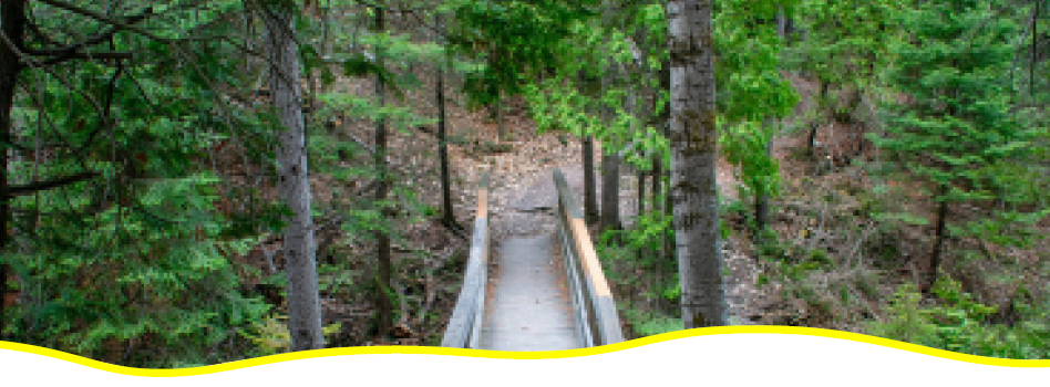
City of Greater Sudbury – Bethel Lake Trail
The Bethel Lake Trail in the City of Greater Sudbury connects to Ramsey Lake Trail just next to Laurentian University on one side and to the East Area trails on the other.
Considered moderate in difficulty, this trail contains sections of boardwalk, gravel and natural path, and is a great option for walking, mountain biking and snowshoeing. Take in lake and forest views along the way, keeping an eye out for birds.
City of Greater Sudbury – Junction Creek Waterway Park
The City of Greater Sudbury Junction Creek Waterway Park trail system runs for just over five kilometres. Walk, hike, cycle or snowshoe through wooded areas made up of white birch, willow and poplar trees.
The Junction Creek Waterway Park trail system consists of several shorter options, connecting Sudbury’s urban community to the surrounding natural environment. For beginners or those looking for an easier option, the Fisher Wavy Trail is a good bet for a walk or snowshoe along Junction Creek.
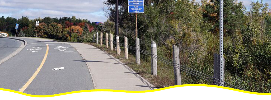
City of Greater Sudbury – Ramsey Lake Trail
The City of Greater Sudbury – Ramsey Lake Trail is ideal for walking, hiking or biking. Perfect for commuters and those seeking outdoor time in an urban setting, the paved trail follows Ramsey Lake Road and offers lovely lake views, connecting with Bell Park Walkway on one end and Bethel Lake Trail just past Laurentian University. It’s a great way to explore Sudbury on foot or on two wheels!
City of Greater Sudbury – West Area
Walk, hike or cycle on this rural and urban trail in Greater Sudbury. The west area includes two options: Hillfield Trail and Kelly Lake Trail. Hillfield Trail is a walking, biking and snowshoeing trail featuring boardwalk, stairs and natural paths in a forest setting.
Look out for fairy houses and troll huts along the way! Kelly Lake Trail is another great walking, mountain biking or snowshoeing option. Enjoy lovely lake views en route and be sure to stop at the bird sanctuary. Both trails includes barrier-free sections: Hillfield Trail for 750 metres and Kelly Lake Trail for one kilometre.
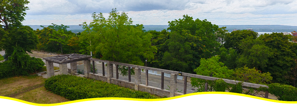
City of Hamilton
Walk, hike, bike or cross-country ski on an urban paved trail in Hamilton, Ontario. A highlight of the City of Hamilton trail network is the Escarpment Rail Trail, a paved multi-use trail that was developed on an old rail line.
Begin near Albion Falls and journey via forested trails to the lower city, enjoying the urban, harbour and rock cliff views along the way. Stop for a snack in Corktown or on trendy Augusta Street. Access the Trail via five separate entrances or one of two sets of stairs.
City of Kenora – Lake of the Woods Trail
The Trans Canada Trail within Kenora includes portions of existing trail networks within the city. In Kenora, stop for a drink at the Lake of the Woods Brewery or the Muse, the Lake of the Woods Museum!
On the Rat Portage Urban Trail, meander through an urban setting and along Laurenson’s Creek nature walk, and past McLeod Park, home to the 40-foot-tall fish sculpture, Husky the Muskie! Downtown Kenora is home to several restaurants and cafés, perfect to stop for a snack or a rest along your route. At Anicinabe Park’s public beach, cool down on a warm day with a dip in the lake.
On the 4.3-kilometre Mink Bay Trail system in Keewatin, in Kenora’s west end, hike, bike or cross-country ski through wetlands and boreal forest, then into downtown Keewatin.
City of Peterborough
This four-season trail runs from the Regional Municipality of Durham (near Uxbridge) to the City of Peterborough. Rich in history, the route follows a former railbed which was active from 1858 to 1988. This trail links parkland, farmland, the natural environment and five communities, including Lindsay, home to one of Canada’s most sustainable schools, with wind turbines, green roofs, community gardens and solar energy projects.
Further east, the trail goes through downtown Omemee, the childhood home of Neil Young, where you can visit the Youngtown Rock and Roll Museum. Stroll along Little Lake on the Otonabee River or explore Jackson Park, one of Peterborough’s largest parks. Admire outdoor sculptures or stop for a snack in downtown Peterborough, just off the trail.
Whether you’re walking, hiking, cycling or cross-country skiing, the City of Peterborough Trail is a great option for families and people of all ages and experience levels.
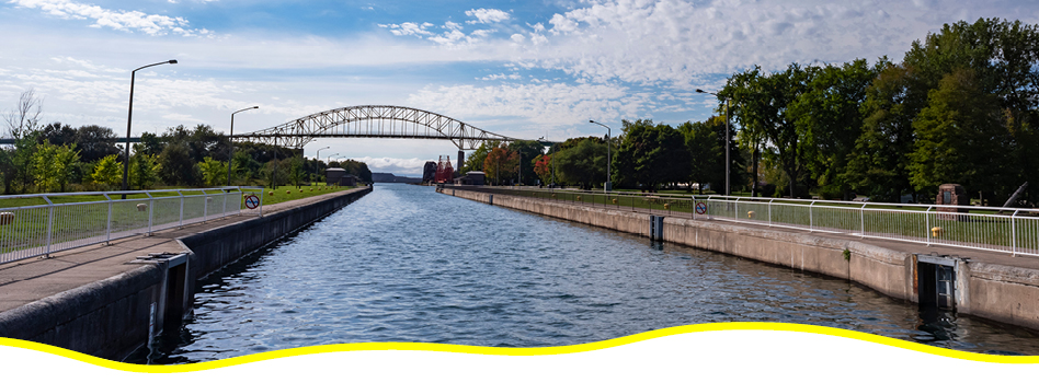
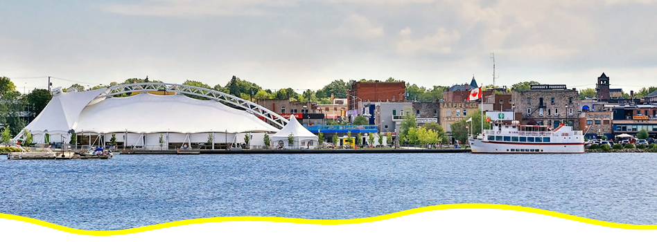
City of Sault Ste. Marie
History meets natural beauty on the City of Sault Ste. Marie Trail. Enjoy this accessible 22.5-km paved trail and explore several points of interest along the way.
Begin at the Roberta Bondar Pavilion on the waterfront boardwalk, and walk, hike or bike to the city’s main attractions, like the Sault Ste. Marie Canal National Historic Site, Bellevue Park and the lovely Fort Creek Conservation Area.
The Hiawatha Loop Trail is a more challenging option featuring varied forest trails — which are particularly lovely in the fall — and a stunning waterfall with two lookouts.
Durham Region
The Trans Canada Trail in the Durham Region starts near Pickering with gorgeous views of Lake Ontario and connects users to the hugely popular Kawartha Lakes Region.
Start in downtown Uxbridge and make your way to Elgin Park, which is home to a playground that the little ones will love. Take in the diversity of flora and fauna along the Beaver River section.
If you want to journey farther, head to the Durham Regional Forest, a 600-hectare park with excellent options for hiking, cycling and cross-country skiing. Other sections of the trail are moderately difficult, with some challenging steep descents and ascents, but wherever you are on the trail, you’ll be treated to picturesque farmland views.
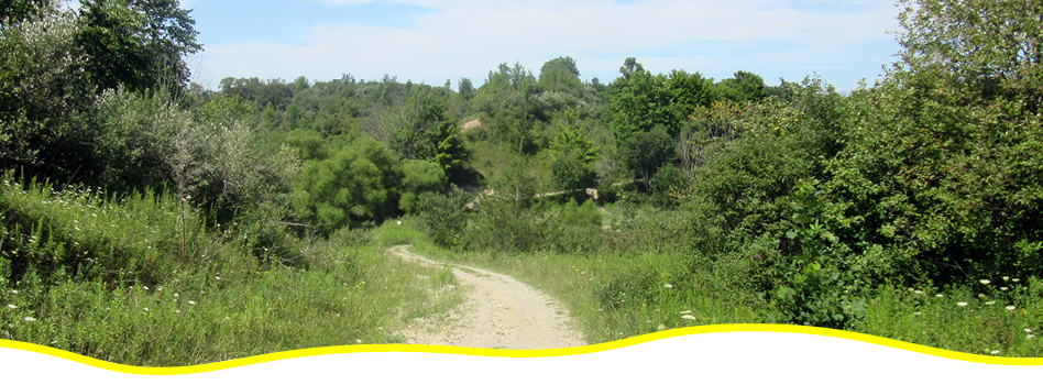
Dutton-Dunwich Trail
The Dutton-Dunwich section of the Trans Canada Trail offers users the perfect mix of tranquility, history and culture.
Hike, cycle or horseback ride along quiet country roads, picturesque hills and valleys, calming streams and undisturbed woodlots and wildlife. In the winter, cross-country skiing is a popular choice.
History buffs will love the 19th-century church and cemetery along the way, and the nearby Backus-Page House Museum offers a glimpse into life in the 1850s. Note that sections of the trail are closed during black powder hunting season.
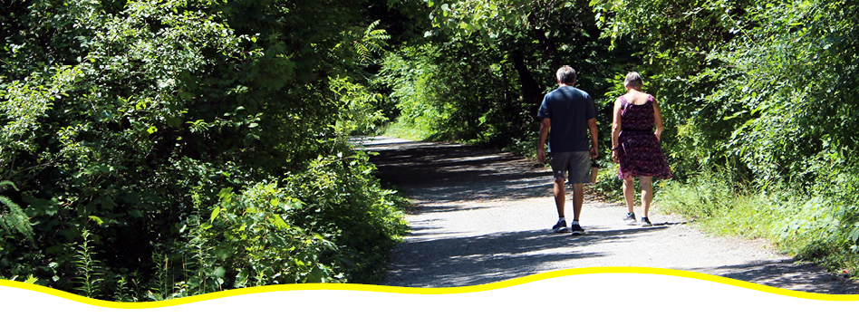
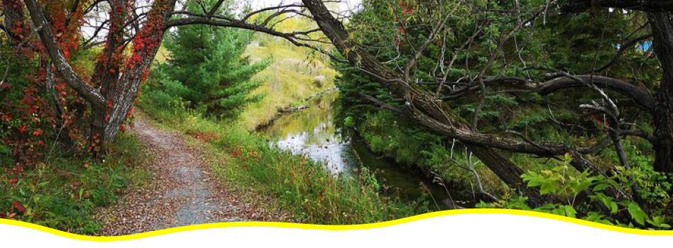
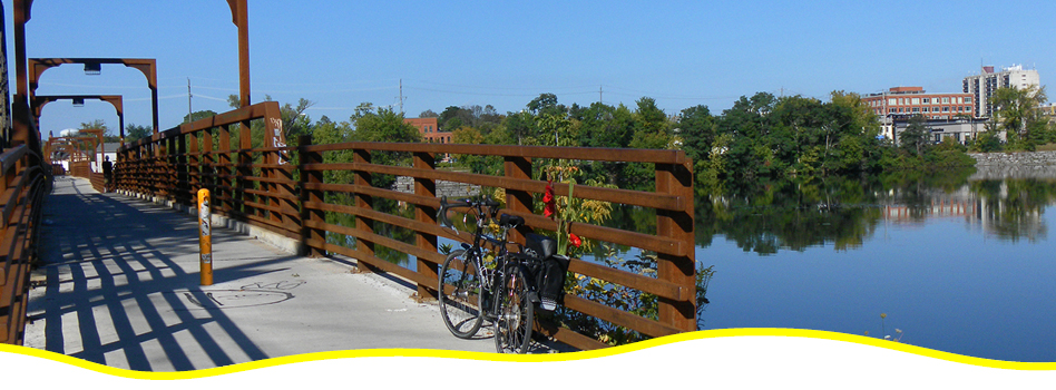
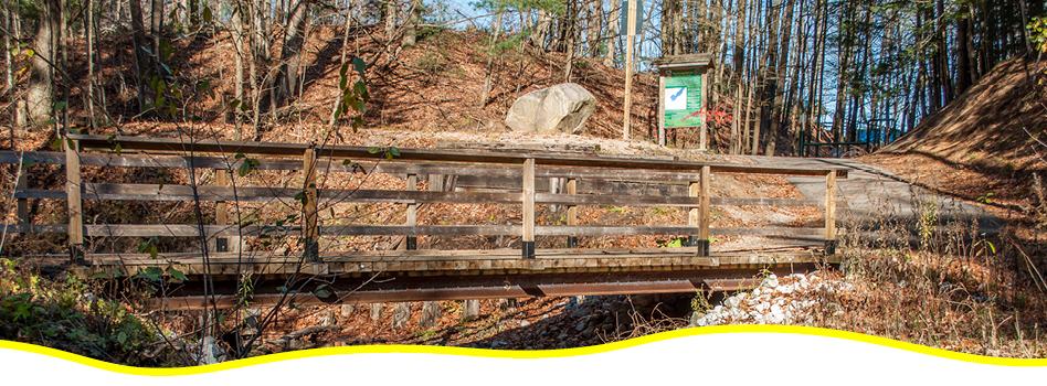
Jackson Creek Kiwanis Trail
Hike, walk or cycle along this multi-use trail that extends from Jackson Park in Peterborough to Selwyn Township. A former CN Railway line, purchased by the Otonabee Conservation in 1992, the railbed provides an excellent base for the trail – it’s flat and wide, making it a great choice for a family outing with hikers or cyclists of all ages.
The star of the trail is its namesake: Jackson Creek. Take in the beautiful views and enjoy the region’s diverse flora and fauna while passing through upland and lowland forests, farmland, valleys and wetlands. The trail is home to four bridges that provide optimum viewing opportunities of the area.
K&P Trail
Following the former K&P Railway line, this section of the Trans Canada Trail runs from downtown Kingston to Sharbot Lake, and further north into the County of Renfrew. The K&P Trail features many loops that link to regional trail systems, that allow trail users to explore several communities including Tichborne, Godfrey, Verona and Harrowsmith.
In Verona, stop for a meal or check out the charming shops, then head to McMullen Park Beach for a trip to the playground or for a swim at the beach. In Sharbot Lake, don’t miss the Railway Heritage Park. The trail offers options in all seasons, from hiking and biking to skiing and snowmobiling.
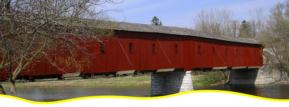
Kissing Bridge Trailway
The Kissing Bridge Trailway is a flat, wide trail built on a former railbed. It winds through southern Ontario’s wetlands, farms and wooded areas, passing by rural communities en route.
Take a short detour to see the impressive West Montrose Kissing Bridge. Built in the late 19th century, it’s the last covered bridge in Ontario, crossing over the Grand River in the village of West Montrose.

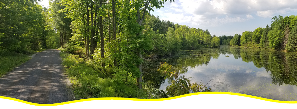
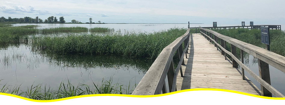
Lake Superior Water Trail
Spanning close to 1,000 kilometres, the Lake Superior Water Trail is a wonder to behold, bringing the earth’s greatest expanse of freshwater into sharp focus. The Trail runs between Gros Cap Marina Park in Whitefish Bay all the way to Fisherman’s Park in Thunder Bay, passing through several provincial parks.
In the stunning Pusaskwa National Park, take a break from padding and hit the hiking trail, or simply stop for a picnic and a rest on firm ground. In the warmer months, paddle through incredible natural landscapes and reflect on the region’s role as an ancient route. Start off at one of 14 priority and 30 secondary access points that have been identified as safe landing options along the north and east shores. In the colder months, swap the paddles for your snowshoes!
Municipality of Chatham-Kent
The Municipality of Chatham-Kent maintains over 70 km of recreational trails and pathways on a variety of surfaces to appeal to walkers, runners and cyclists.
Check out the Greenfield Global Trail section – this short but sweet section of the Municipality of Chatham-Kent trail network is perfect for walking, running and cycling. This trail is suitable for all levels and is a great option for a family bike trip. Continue along Grand Avenue on a paved shoulder, or loop around the Thames River to head back to town and stop for a drink or snack.
The South Lakeshore Trail section runs along a dike that protects rural farmland in western Chatham-Kent. Perfect for walking, hiking and cycling, this crusher dust trail spans 1,500 metres and is flat and wide, making it a sure bet for users of all ages. Check out the wood carved sculptures along the way, plus the lovely boardwalk and interpretive signage.
The CASO Trail section is located along the old Canadian Southern Rail line. This trail is accessible, flat and three metres wide, making it ideal for users of all ages and skill levels. The Road to Uncle Tom’s Cabin section of the Trail is primarily gravel, with some paved sections. Hike, bike or cross-country ski from Wallaceburg to Dresden and take in the lovely river and farm views.
Niagara River Recreation Trail
The Niagara River Recreation Trail runs from Niagara-on-the-Lake to Fort Erie. The trail is made up of four sections, from Niagara-on-the-Lake to Queenston; Queenston to the Whirlpool Aero Car; Chippawa to Black Creek; and Black Creek to Fort Erie.
Walk, hike or cycle along the beautiful Niagara River and take in the stunning views, or climb up the steep escarpment to Queenston Heights to visit the final resting place of Major-General Sir Isaac Brock, the “Hero of Upper Canada” in the War of 1812. Old Fort Erie, where the trail ends, is also a popular choice for history buffs.
Penetanguishene Trail
A vital link in the Trans Canada Trail network between the Tiny Trail and the Midland Rotary Waterfront Trail, the Penetanguishene Trail leads to many local attractions along the waterfront and offers trail users the opportunity to delve into history all along its route.
Close to beautiful beaches, Awenda Provincial Park and Beausoleil National Park, this Trail section includes limestone, asphalt and paved sections, and also connects with the Copeland Creek Trail and the Discovery Harbour Trail.
Journey on waterfront paths through the beautiful Rotary Champlain Wendat Park, a fascinating part of Canadian and Indigenous history. The park includes a playground, a swimming area, a dog park and lovely picnic spots.
Thornton-Cookstown Trail
Head out on this shared-use trail that runs between Thornton and Cookstown in Ontario. This rail trail winds its way through green pasture land and forests, and crosses over the beautiful Crosstown Creamery Creek six times.
Enjoy the colourful wildflowers along the trail, and watch for deer, rabbits, foxes and more. Beaver activity is also easy to spot from the trail. This rail trail is a great choice for users of all levels. In Cookstown, stop for a meal or a treat, then check out the town’s charming antique market.
Tiny Trail
The Tiny Trail runs north of Elmvale, parallel to County Rd 6, then northeast to the town limits of Penetanguishene. Pass through prime agricultural land and hardwood forest, crossing over the Wye River and Copeland Creek. The trail is a popular choice for activities of all types, from hiking and walking to horseback riding, cycling and winter sports.
Check out 15 historic bridges along the way, including the Concession 2E Railway Bridge, built in 1878 and an Ontario Heritage Act cultural heritage property. Nearby, visit the Ossossane Ossuary and the Tiny Marsh Wildlife Area.
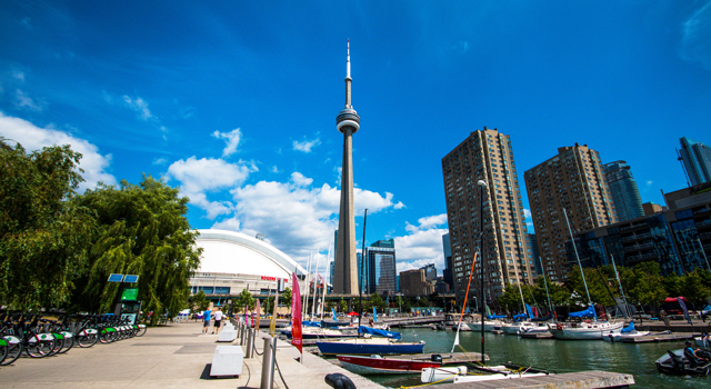
Waterfront Trail
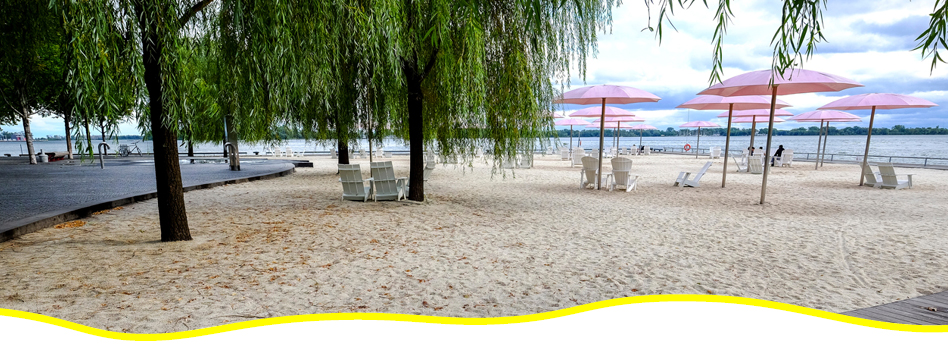
This section of the Trans Canada Trail runs along the Lake Ontario shore from Burlington to Toronto, through Oakville and Mississauga, covering 87 kilometres of paths, residential streets and parks. Walkers, hikers and cyclists will enjoy natural areas like the Royal Botanical Gardens in Burlington, the Rattray Marsh in Mississauga, the Humber Bay Butterfly Garden and Music Garden in Toronto.
Walk or bike through downtown Toronto along the shore of Lake Ontario and the Western Beaches. The City of Toronto section of the Waterfront Trail provides excellent city and lake views, and passes by highlights like Sugar Beach, Harbourfront Centre and the CN Tower. Stop for a coffee or a bite to eat — Toronto is known for its superb culinary scene — then head back outside. This trail is accessible by public transit and can be quite busy at times; it’s an ideal commuting path for those looking to fit outdoor time into their everyday lives.

After each hike, share photos or videos of your adventures with us!
Each photo or video submission gets you an EXTRA entry for even more chances to win amazing prizes.
Upload here or share on social with the hashtag #GreatCanadianHike to participate.
Check out the Prizes up for grabs!