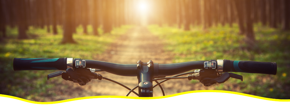
Featured Hikes: Quebec
Rightly known as ‘La Belle Province’, Quebec offers outdoor explorers a fascinating mix of rich Indigenous heritage, European culture and incredible natural beauty. All this is waiting to be explored on this unique province’s section of the Trans Canada Trail along the two shores of the Saint Lawrence River.
Discover our Featured Hikes in Quebec.
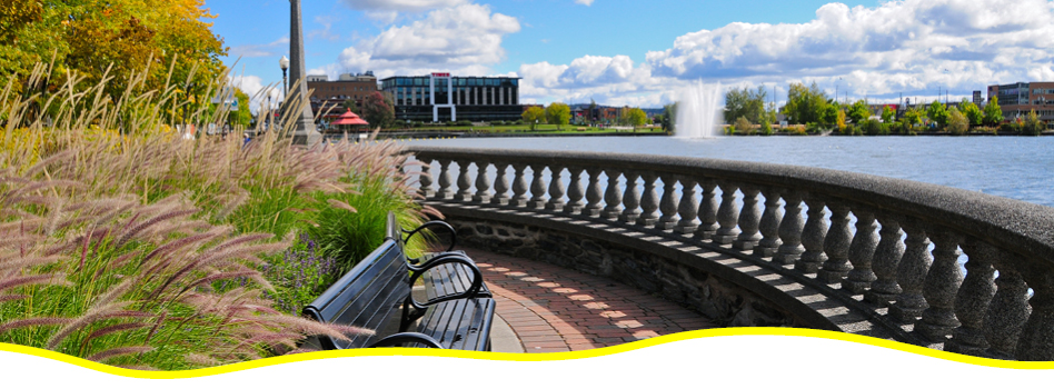
 Corridor du Littoral
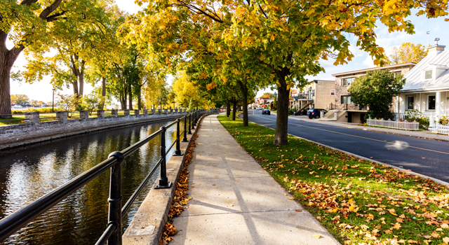
Corridor du Littoral is an urban paved trail in Quebec City that runs from near the Château Frontenac along the shores of the Saint Charles River and Beauport Bay to the Parc de la Chute-Montmorency. Cycle, walk or inline skate along the Trail as you pass through Quebec City’s Old Port, the old city with its beautiful buildings and charming streets, and lovely river and port vistas. Some sections of the Trail are accessible.
Several entry and exit points are available, so you can jump on and off the Trail as you like to stop at one of Quebec City’s many bistros, cafés or breweries. Don’t miss Montmorency Falls, which makes a great stopping point at the end of the Trail for a picnic or rest. For those looking for a longer outing, the Trail syncs up with the Île d’Orléans bridge, so you can continue on a cycling circuit around the island. In the summer and fall, be sure to stop for strawberries!
La Montagnarde
The Montagnarde is a 45-kilometre cycling trail that passes through the beautiful Memphremagog region of the Eastern Townships in Quebec. Start out in the charming village of Eastman and continue past Mount Orford, through Cherry River and around Magog. Walk, hike, cycle, cross-country ski or snowshoe through rural landscapes, taking in the beauty of the region, rich in lakes and mountains, as you pass through forests and along Lake Memphremagog. Orford is particularly beautiful in the autumn, boasting a stunning display of fall colours.
In Magog, stop for a bite to eat or a coffee on the lively main street, or head to the Musée international d’art naïf de Magog to delve into naïve art from the region. The area is also home to several excellent spas if you’d like to add some pampering to the agenda.
La Traversée de Charlevoix
Explore the incredible Charlevoix region, a designated UNESCO World Heritage Site known as the Charlevoix Biosphere Reserve. Walk, hike, bike or cross-country ski along backcountry trails spanning 105 kilometres, linking the Parc National des Grands-Jardins to Mont Grand-Fonds. Explore boreal forest, surrounded by summits climbing up to 850 metres.
Take in the stunning views of Parc National des Hautes-Gorges-de-la-Rivière-Malbaie, plus surrounding lakes, mountains and rivers. Hiking and snowshoeing options range from 5 kilometres to multi-day treks. The Sentier du Dôme is a 7.8-kilometre loop that boasts incredible views of Baie-Saint-Paul and the Saint Lawrence estuary. Climb the trail through a regenerating forest that was destroyed by a fire in 1991. Chalets are available to rent along the route for those looking for a longer trip. Note that registration is required, and the trail is not patrolled. The trail includes some steep slopes.
Le Corridor des Cheminots
Le Corridor des Cheminots is a lovely 25-kilometre urban paved trail in Quebec City that starts in Cité-Limoilou and passes through several residential communities, including Neufchâtel, Val Belair and Val-Saint-Michel en route to Shannon. Several parking and access points are available along the Trail. Walk or hike, cycle or rollerblade along the Trail as you cross residential neighbourhoods and parks. Learn more about the history of New France at the Domaine Maizerets historical site, which includes exhibitions, gardens and an arboretum.
In Wendake, stop to check out the Huron-Wendat Museum, where you can view the permanent exhibit and visit a traditional longhouse, where a member of the local community will recount stories and legends. For a taste of local Indigenous cuisine, check out La Traite, La Sagamité or NEK8ARRE.
Les Grandes-Fourches
This cycling, walking, inline skating or cross-country skiing circuit follows the Magog, Massawippi and St. François rivers as it transects Sherbrooke, Lennoxville, Deauville and North Hatley. Start out in Sherbrooke, where you can fuel up at a local café or restaurant—choices abound!—or stop at the Marché de la Gare for fresh local produce.
In Lennoxville, visit Bishop’s University, where the 19th-century neo-Gothic St. Mark’s Chapel is classified as a heritage building. North Hatley is a charming village on the shores of Masswippi Lake, home to cafés, shops and a public beach, perfect for a picnic or as a spot to cool down after a day on the Trail. Deauville features a lovely sandy beach.
Those looking for a longer ride can follow the Trail to link up with La Montagnarde between Deauville and Magog. Note that the Trail is a combination of paved and gravel roads, and includes sections with motorized vehicles.
L’Estriade
This gem in the Eastern Townships loops from Granby to Waterloo and back again, with sections in Parc National de la Yamaska. This accessible trail—with a maximum slope of 2%—is a delight for cyclists, hikers and rollerbladers. The Lac Boivin section is a great option for families and cyclists at all levels. The Centre d’Interprétation de la Nature du Lac Boivin is worth a stop, with a flat walking trail around the lake, observation towers and interpretive panels about the surrounding nature and wildlife.
Along your route, journey through wetlands, open fields, forests and parks. Discover over 60 monumental sculptures, plus spectacular views of Mont Brome and its ski trails. Visit Relais des Cheminots for tourist information and maps, or stroll through the picturesque town of Waterloo and admire its historic buildings along the town’s Circuit du Patrimoine.
Parc linéaire des Bois-Francs
This 77-kilometre rural trail is built on the site of an old railbed, making for an easy hike, walk or cycle. The mainly gravel path is patrolled for users’ safety and winds along historic bridges and riverbanks. Access points can be found throughout the trail.
Enjoy mountain views and pastoral landscapes, stopping to sample tasty treats in one of nine charming municipalities the trail intersects along the way, including Warwick, Victoriaville, Plessisville and Laurierville.
In Kingsey Falls, stop at the Parc Marie-Victorin to enjoy over 13,000 beautiful flowers and plants. In Warwick, stop at the award-winning Fromagerie du Presbytère to sample delicious cheese. The trail also passes near the Wilfrid Laurier House National Historic Site of Canada, once the home of Prime Minister Wilfred Laurier.
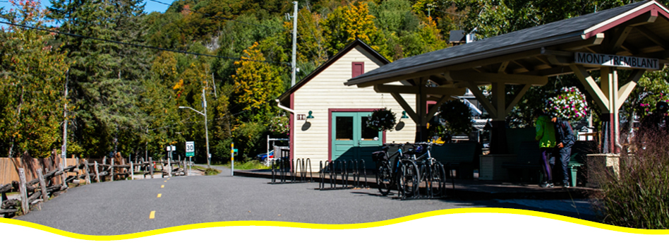
Parc linéaire Le P’tit Train du Nord
Just north of Montreal, Le P’tit Train du Nord linear park features a 232-kilometre path built over a former railway line. Running from Saint-Jérôme to Mont-Laurier, this gentle gravel trail takes outdoor enthusiasts through picturesque countryside, charming villages and restored train stations.
This trail runs through the Laurentians from Mont Laurier to Bois-des-Filion on the old railway line, built in the 1890s. Walk, hike, cycle or rollerblade alongside lakes, rivers and mountains, passing through lively tourist towns and cottage areas. Many services are available, including convenience and bike stores, hotels, inns and campgrounds, pubs and restaurants.
Don’t miss Parc National du Mont-Tremblant, a great venue for hiking, walking and camping, and the village of Mont-Tremblant, filled with delicious restaurants and cafés, plus spas if you’re up for a little pampering. The trail is relatively flat with a few long gradual slopes. The north-to-south route is downhill, letting cyclists coast for long stretches.
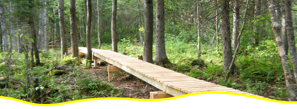
Sentier Des Pointes
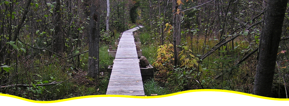
Hike, walk or snowshoe along this forested trail. This 10.9-kilometre-long trail includes an elevation of 300 metres. Start out at the end of the Sentier Les Florent, then wind through varied boreal forest, crossing over creeks via footbridges and boardwalks over swampland on your way to the village of Saint-Urbain. Check out the beaver dam and the resulting pond. Near the end of the trail, take in a panoramic view of the surrounding valley, then continue to the picnic area for a snack and a rest.
Access points are available on the north end at the rest area du chemin des Pointes, or on the south side across from the Centre de l’Emeu de Charlevoix, where you can learn all about emus and pick up some emu products, and the Ferme Basque de Charlevoix, a duck farm offering up foie gras and other delicacies.
Sentier Gabrielle-Roy-Est
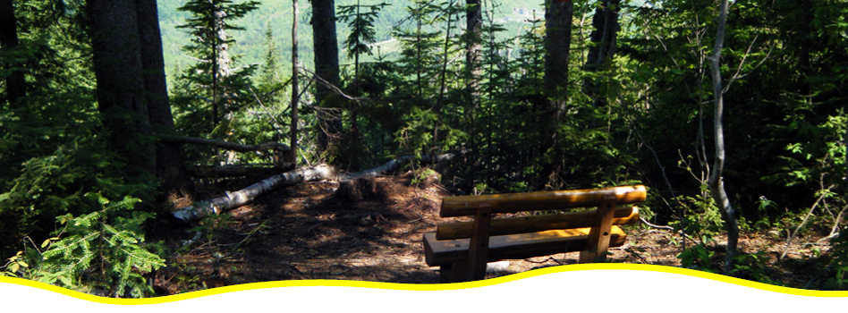
An ideal walking, hiking and snowshoeing trail, Sentier Gabrielle-Roy-Est is a wilderness dirt trail through boreal forest, ascending Mont Gabrielle-Roy. Watch how the forest evolves as the trail climbs up towards the summit.
This trail offers up seven stunning viewpoints, including a 360-degree view of the Charlevoix region’s mountains, forests, and the Saint Lawrence River dotted with islands. At the summit of the trail, benches and a picnic table provide the perfect resting and snacking spot. There’s a reason this trail is the most popular in the region!
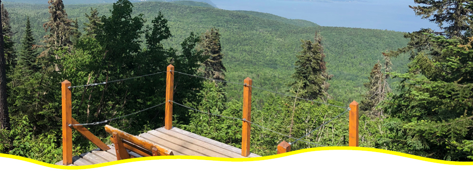
Sentier Gabrielle-Roy-Ouest
This dense forest trail is the perfect place to spot moose, who inhabit the area in large numbers. Walk, hike, ski or snowshoe up this winding trail to the summit of Mont Liguori, the highest summit in the area boasting incredible views of the Saint Lawrence River and l’Isle-aux-Coudres. Cross over tranquil streams and rivers along the way. This trail is appropriate for more experienced users. Several access points are available.
Sentier Louise-Gasnier
The Louise-Gasnier Trail links the Gabrielle-Roy-Est and Gabrielle-Roy-Ouest trails. This easy to moderate trail winds through diverse forests and features boardwalk sections, plus two impressive suspension bridges over the Sault River.
Stop for a rest at the picnic area, or head into the village of Petite-Rivière-Saint-François for a snack after the hike. Note that two footbridges are under construction, so it’s recommended to check with local authorities before setting out.
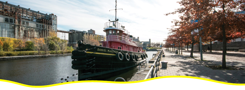
Ville de Montréal
Discover Montreal’s eastern and northern ends as you follow the City of Montreal Trail from the city centre. Start out next to Parc Lafontaine, a popular spot for picnics, jogging and cycling in the summer, and ice skating in the winter.
In the Plateau neighbourhood, stop for a coffee, drink or snack on Duluth or Mont-Royal avenues. The area is brimming with delicious cuisine, charming shops and great bars. Continue northward through Parc Laurier through Rosemont Petite-Patrie to Ahuntsic, passing through several parks and residential areas, ending up at the Parc de la Merci, a lovely waterfront picnic spot.
For an alternate route heading east, journey east from Parc Lafontaine through Hochelaga-Maisonneuve, home to cafés, ice cream shops and restaurants, onwards to the easternmost end of the island in Pointe-aux-Trembles.
The City of Montreal Trail is ideal for cyclists, walkers and joggers, and inline skaters. Note that some sections share the roadway with motorized vehicles.

After each hike, share photos or videos of your adventures with us!
Each photo or video submission gets you an EXTRA entry for even more chances to win amazing prizes.
Upload here or share on social with the hashtag #GreatCanadianHike to participate.
Check out the Prizes up for grabs!